5/5
阳江南鹏岛是还没开发的海岛,海水清沙幼,可以自带浮潜用具浮潜,广东的马尔代夫。适合野外求生,朋友小聚,自制烧烤,很棒的哦 huang244483
5
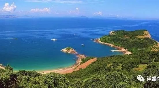
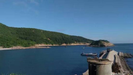
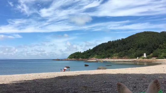
Nanpeng Island is located in Dongping Town, Yangjiang, Guangdong Province, about 12 nautical miles from the land, covering an area of about 1.24 square kilometers. It consists of two hills, which look like a Dapeng spreading its wings when viewed from the side, hence the name Nanpeng Island. Looking down into a figure-8 shape from east to west, the mountain to the east is not difficult. There are two or three lawns on the mountain, and there are over a thousand cattle and sheep on the island, which have now been contracted to operate. The vegetation on the mountain is dominated by dwarf pine trees and Quan wood bushes, so you must wear hiking shoes or sports shoes and long shirts and trousers to avoid scratches. The mountain in the west is relatively steep, and there is a water source on the mountain, which is a natural mineral water. There are many mines dug by the Japanese army on the mountain. But most of them are now closed. The highest point on the island is the nautical lighthouse at 191.5 meters. A sandy beach about 150 meters south of the pier is a very ideal camping site. This is the intersection of the figure 8. The beach traverses the island, facing the sea from north to south. One side is windy and waves are high, and the other side is calm and calm. should. There are a large number of wild sea urchins and sea cucumbers in the shallows of about one meter. The sea water is clear and transparent, and sea cucumbers and sea urchins can be fished with bare hands.
huang244483