OverviewBookNearbyReviewsWin PrizesRecommended
Share to
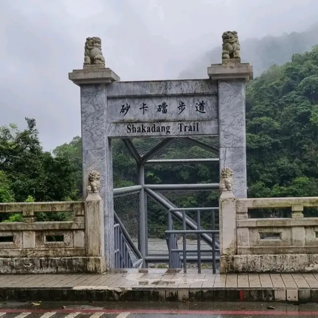
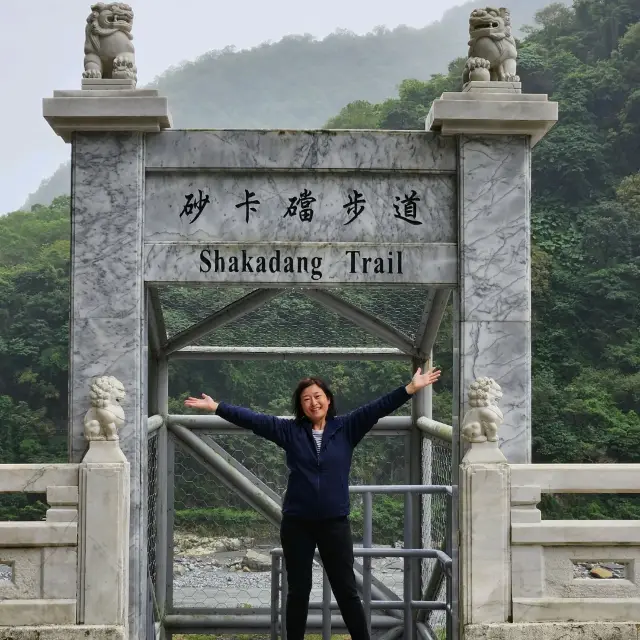
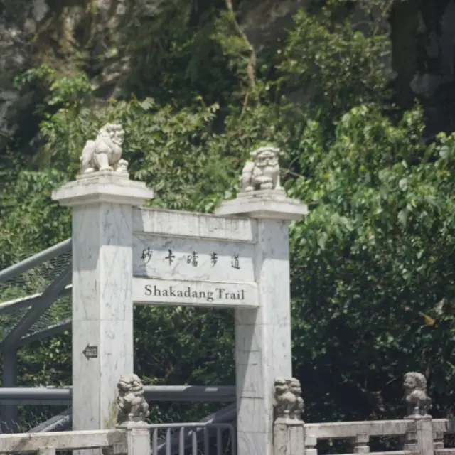
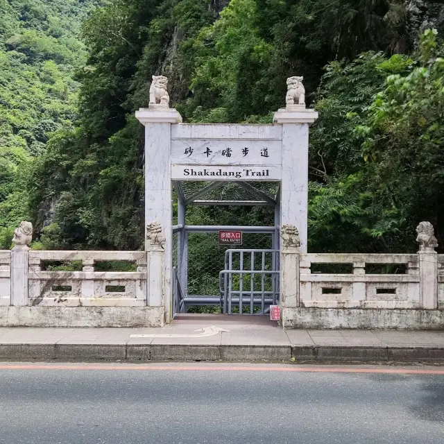
Shakadang Trail
砂卡礑步道2.2
77 Reviews
Open year round, 24/7
Recommended sightseeing time:1-2 hour
Address:
972, Taiwan, Hualien County, Xiulin TownshipMap
Phone+886 3 8621100
What travelers say:
During the Japanese period, the Japanese in order to build the fog power plant, a four-point four-kilometer-long, one-meter-wide trail was dubbed the "mystery valley trail" on the rock wall along the sand cardang stream, and later changed back to the sand cardang trail commonly known as the Tailuge people.
MoreSaved by 12
Shakadang Trail Highlights: Must-See Features and Attractions
Some information may have been translated by Google Translate
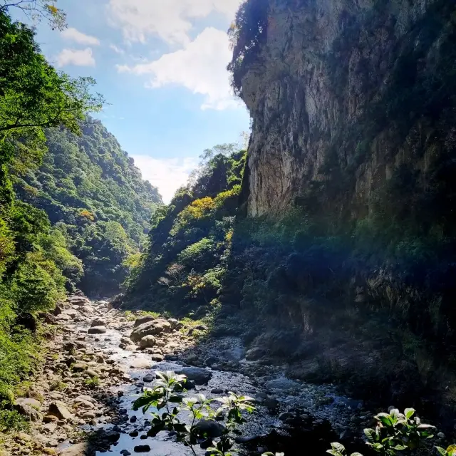
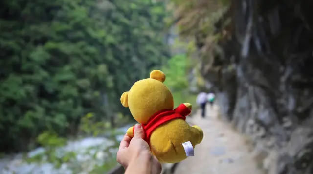
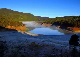
Shakadang (Mysterious Valley) is located in Taroko, where there are magnificent mountains, clear streams and fresh air, and the trails are flat and easy to walk, which always attracts many people to hike every holiday. The name Shakadang originates from the molar teeth that were excavated by the Taroko people when they set up a community here. The local residents believe that it is the historical trace left by their ancestors, so they call this place Shakadang, which is in the Taroko language. Means "molar". The Shakadang River is about 16 kilometers long. The whole trail is along the riverside on the left bank of the Shakadang River. The river bed is covered with large and small stones, mainly marble and gneiss, because the slight acid in the water dissolves. The calcium carbonate in the marble, so the stream often presents a beautiful blue-green, beautiful scenery. There are 2-3 deep pools suitable for diving in Shakadang Creek, most of which are more than 4 or 5 meters deep. It is a pilgrimage place for many diving enthusiasts. In addition, there are many waterfalls, and there are many natural SPA waterfalls in Shakadang Creek. , forming a beautiful landscape of Shakadang Creek.
Explore near Shakadang Trail: Where to Stay, Eat, and Visit
Shakadang Trail Reviews: Insider Insights and Visitor Experiences
Some reviews may have been translated by Google TranslateWrite a Review
/5
Outstanding ReviewsAll (77)
Latest
With Photos (60)
Positive Reviews (70)
- 1
- 2
- 3
- 4
- 16
Frequently Asked Questions About Shakadang Trail
Shakadang Trail Photos: Trip Moments
 beautiful Shakadang TrailFirst stop at Shakadang Trail to start our Taroko Gorge experience. Noted that the Shakadang Trail was built during Japanese Occupation for hydroelectric power. The one-way length of Shakadang Trail is 4.1 km, and we have to do a loop to return to the starting point. it's a relatively easy trail. midway throwing, there are some shops in the 5 cabins where you can buy food and drinks. the turquoise colour in the river was beautiful, and the magnificent boulders and cliffs are the highlights of this hike. the view was really nice at every turn and twist. It is one of the best stops of the Taroko Gorge. should put in your itinerary if you are visiting Hualien.charlini25
- newyearadventure
- trail
- taiwan
- hualian
- nationalpark
- taroko
- hiking
- scenic
The Gorgeous Taiwan Natural Scenery#newyearadventure #trail #taiwan #hualian #nationalpark #taroko #hiking #scenic When you are travelling to Hualien, you will definitely go pass the Taroko National Park a beautiful scenic huge national park located in the middle of Taiwan. And if you like hiking this is the place you should go! Shakadang Trial is a trial visited by many tourists and its a well pathed and marked trial, it will take you approximately an hour one way and you will be greeted with beautiful rock formations, blue clear waters and fresh air! Half way thru the shakadang trail there is a little shop that sells food, your local Taiwanese food and homemade drinks. Have a good rest here, and if you do decide to head back, this is the half way mark to u turn.Kinnie Kong7
- thingstodo
- taiwan
- shakadang
- naturewalk
- nature
Experience pristine nature @ Shakadang trail#thingstodo Name of location: Shakadong Trail Address: 📍 972, Taiwan, Hualien County, Xiulin Township User rating: 8.5/10 Location details: Taroko national park covers a wide range and has many attractions including swallow cave, buluowan, beipu, tunnel of the 9 turns and taroko gorge which is featured in my other post. Quite difficult to get to, requiring a special bus from hualien bus station (Next to the train station) you can buy bus tickets at the hualien county information centre which will take you up the national park trail. Do becareful as as of 2023 December some parts are closed off due to an avalanche earlier in the year. Also not all buses stop at every station! So do becareful on your travels. The most important tip is to watch for the bus timings on the way down as you will be trapped if you miss the last bus and will need to take expensive private transport down! The last bus is usually around 3-4 PM Experience details: The shakadang trail is a lovely trail to walk for a naturesque hike and fresh air if you enjoy being in nature. It is also not too difficult for beginners as i even saw elderly walking the trail! Good spot for spotting birds as well with many photographers in the area attempting to capture the local wildlife. The best part of the trail was the hikers village at the end which used to be a stop point for travellers going through the mountains. Now they serve hot drinks and food! Must try is their local coffee and sausages!!! some tips is to use the toilet before hand because there are no modern restrooms on the trail. Also the entire trail could take up to 5 hours to hike! #taiwan #shakadang #naturewalk #natureKimweez
- exploreasia
- couplestrip
- awesomepic
- taiwan
- taroko
- hualien
- shakadang
Exploring Taroko - Shakadang Trail!#exploreasia Shakadang trail or also know as Mysterious Valley Trail is one of the trails located in Taroko National Park. It is a trail by the river cliff but it is not too difficult. I personally did not manage to finish the trail due to the lack of time. The view was stunning. From the entrance of the trail, you get to see the Shakadang river leading down to the Liwu River. We were lucky to see the jade green waters at the Shakadang trail as we went after typhoon which caused most the main streams to have murky waters. It would be good to wear a pair of comfortable walking / hiking shoes and do take note you might get wet at some areas. 10/10 for the view! #couplestrip #awesomepic #taiwan #taroko #hualien #shakadangArqueee7
 Crystal Clear Turquoise WaterThe Shakadang Trail, also known as Mysterious Valley Trail is an easy, well-maintained trail in Taroko National Park. The trail is 4.1 kilometers one way to Sanjianwu, it is an out and back trail and goes along with winding crystal clear turquoise water strewn with imposing marble boulders. The entrance to the trail is located at the exit of Shakadang Tunnel and includes a parking lot and bathroom facilities. You can take bus 310 bound for Tianxiang and alight at Shakadang trail. This trail is mostly flat and built along the river cliff, so travellers can easily observe both the rock folds and plants. While hiking half way, you will reach a set of stalls, selling traditional foods and crafts.RTCY7
 The Sakhalu Trail is located in the Taroko National Park. As early as the Japanese occupation period, the Japanese built a 4.4-kilometer-long, one-meter-wide trail from the rock wall along the coast. Known as the "Mystery Valley Trail", it was later changed back to the "sgadan" of the Tailu name, which means "tooth decay." After the park was established, the road was planned as a landscape trail and a rest platform was added. In recent years, it has become a popular tourist attraction in Hualien. If it takes more than an hour to go back and forth, it is recommended that you take a walk. The most important thing is to understand how hard it is for the ancestors to dig out this trail.carina..
You Might Also Like
Qingjing Farm
5.2
4.6/5646 Reviews
From US$5.53
Qingjing Farm
4.5
4.6/5270 Reviews
From US$5.53
Formosan Aboriginal Culture Village
4.8
4.8/5222 Reviews
Save US$11.94
From US$27.63
Taipingshan National Forest Recreation Area
3.2
4.7/556 Reviews
Save US$1.56
From US$4.58
Nearby Attractions
Ch'ing-shui Cliff | Qixingtan Scenic Area | Taroko National Park | Whale Watching Experience in Hualien | Huadong Valley | Farglory Ocean Park | Cave of Water Curtain | Pine Garden | Changchun Shrine | Port of Hualien | Farm Dream Estates | Huatang Museum | Qingshui Cliff | Taroko Swallow Grotto Trail | Hualien Fly | Huilan Bay | Qixing Lake Binhai Bicycle Road | Hualian Railway Cultural Park | Chihsing Lake Yuanyue Farm | Mugua River Farm | Changjinglu Parent-Child Park | Manor House | Hualien Ji-An Shrine | Emerald Valley | Baiyang Trail | Jiuqu Cave | Liyu Lake | Tianxiang Scenic Are | Chisingtan Katsuo Museum | Hualien Cultural and Creative Industries Park
Popular Types of Attractions in Hualien
Parks | City Parks | Aquariums | Zoos | Architecture & Landmarks | Historical Architectures | Featured Neighborhoods | Modern Architecture | Nature | Attractions | Mountains | Lakes | Religious Sites | Churches and Cathedrals | Temples | Other Places of Worship | Exhibition Centers | Museums | Art Museums | Exhibition Halls | Outdoor Sports | Hiking | Hiking/Biking | Golf Courses | Popular Spots | Historic Sites | Historical Sites | Cemeteries | Ancient Trails | Lifestyle
Popular Restaurants in Hualien
Oh La La fashibaobing · Home-Style Cooking | 洋基牧場 | 液香扁食 | Erouxiansheng | 戴記扁食 | STARBUCKS Hualian Shop | Huilanshudao | Soaring Cloud Western Restaurant | Starbucks Coffee | 花蓮香扁食(中正店) | Laisangshousiwu | 米当烤肉 | 高氏仙の屋 | 泰泰廚房 | Cengshifuzhengshougongmashu (hualianhuochezhanzhanqian) | 竹陽活海鮮 | Laoxiang Beef Noodles | Mr. Sam-山姆先生咖啡館 | 榕樹下面店 | 滿妹豬腳 | Liminghongchadian | 英倫庭苑西餐廳 | 璞石咖啡館 | Doing Good | 美侖池上便當 | Hualianhuaijiutielubiandang | Qadosh Curry | 豐春冰菓店 | 椿山日本料理 | 惠比須餅鋪
Popular Destinations
Jakarta Travel | Sydney Travel | Tures Travel | Hong Kong Travel | Macau Travel | Kirkiriya Travel | Gauley Bridge Travel | Philippines Travel | Kuala Lumpur Travel | Lahore Travel | Shangrao Travel | Changsha Travel | Copenhagen Travel | Baglung Travel | Gerik Travel | Basundhara Residential Area Travel | Koh Samui Travel | Caticlan Travel | Agharous Travel | Corrego Novo Travel | La Polka Travel | Baddi Travel | Mangwadgaon Travel | Kohor Travel | Talagskiy Gorodok Travel | Dalton Township Travel | Sinio Travel | Belyaevo Travel
Recommended Attractions at Popular Destinations
Bangkok attraction near me | Tokyo attraction near me | Manila attraction near me | Hong Kong attraction near me | Taipei attraction near me | Seoul attraction near me | Los Angeles attraction near me | New York attraction near me | Shanghai attraction near me | Kuala Lumpur attraction near me | Shenzhen attraction near me | Osaka attraction near me | Singapore attraction near me | Guangzhou attraction near me | London attraction near me | San Francisco attraction near me | Beijing attraction near me | Macau attraction near me | Bali attraction near me | Paris attraction near me | Ho Chi Minh City attraction near me | Orlando attraction near me | Jakarta attraction near me | Chicago attraction near me | Phuket attraction near me | Toronto attraction near me | Istanbul attraction near me | Dallas attraction near me | Cebu attraction near me | Seattle attraction near me
Trending Travelogues
Popular Trip Moments
Beautiful scenery at Hualien | Hualien | Cute and Delicious Pancakes | Xiao He Bu Lang | Hualien | Early Morning Citywalk | Sunrise Boulevard | Hualien | Instagram-style Hillside Ocean View B&B | Muxi B&B. | Ruisui Tourism | Hualien's New Japanese Attraction: Little Kyoto [The General's Mansion] | Taiwan | Hualien•Tropic of Cancer•Sanxiantai | Xiaohebulang Hualien Cute Brunch | In this lifetime, one must definitely come to see the sea of Hualien | Hualien East Rift Valley to Qingshui Cliff | Majestic Qingshui Cliff. | The most Aesthetic Starbucks in Taiwan | Hualien, Taiwan’s Largest County | Taroko Gorge | Beautiful Hua lien beaches | Taroko National Park before earthquake | Best location | Taroko National Park | Beautiful city by the sea | Yuli Township, Taiwan | Day Trip to Hualien | Experience pristine nature @ Shakadang trail | Breathtaking Views and Coastal Splendor | The Majestic Beauty of Taroko Gorge | Cozy Comforts and Convenient hostel | My holiday, my way | 花蓮太魯閣Hualien Taroko | Absolutely beautiful | Hot Spring water playground in Taiwan
Popular Travel Types
More Things To Do in Hualien
Taiwan eSIM (Real-name authentication required) Day Pass/Data Package QR Code | China&Hong Kong&Macau&Taiwan eSIM Day Pass/data Package (QR code) | eSim Taiwan 1/3/5/7/15 days by Xplori | Asia eSIM Day Pass/Data Package (QR Code) | Taiwan eSIM DATA PLAN (QR Code) | Full-Day Taroko National Park Tour from Hualien City | Taroko Xilaan Trail(departure with 4 people) | Magical Forest Trail(Departure with 4 ppl.) | Angelic Stream Trekking (departure with 4 people) | Kayaking on Hualien River (departure with minimum 4 people) | Aboriginal Cooking Class in Hualien | Qixingtan Fish Fishing Chihsingtan Classic Fishing Tour | 【Hualien | Whale Watching Experience】Doroman Whale Watching | Parent-child river tracing + Laoxi secret waterfall picnic / group of four | Taroko Wenshan Green Water Trail / Group of 4 | 3-Day Private Tour of Taroko Gorge & East Coast Scenic Area | Hualien Motorcycle Rental | Hualien Train Station Pickup | Grizzly Motorcycle Rental | 5-day Taiwan Family Fun Private Tour | Hualien|Pacific Whale Watching + Guided Explanation|City transfer or go on your own | Wild ATV Self-driving Experience | 5-Day Round Taiwan Charter Car Tour | One-day tour to Qixingtan Scenic Area, Hualien, Taiwan, China + Qingshui Cliff + Huadong Valley + Taroko Gorge [One-day tour to Hualien, Taiwan "Blue Dream" whale watching | Canyon scenery] | Taiwan Duoliang Station + Brown Avenue + Ruisui Ranch + Jingpu Tropic of Cancer landmark + Qixingtan Scenic Area one-day tour [Kenting Hualien super beautiful sea view, resort, Chinese and English special car] | Taiwan Duoliang Station + Brown Avenue + Ruisui Ranch + Qixingtan Scenic Area One-day Tour [Kenting-Hualien Single Line, Super Beautiful Sea View, Resort, Chinese and English Special Cars, Itinerary Adjustable] | [Disney Formosa Express] Hualien-Taitung one-way ticket | 5-day Premium Taiwan Eastern Beauty Private Tour | [Disney Formosa Express] Hualien-Kaohsiung one-way ticket | Taroko From Taipei In A Day by Train | [Disney Formosa Express] Taipei-Hualien One-Way Ticket | Private Taroko Gorge National Park Day Tour
Payment Methods
Our Partners
Copyright © 2024 Trip.com Travel Singapore Pte. Ltd. All rights reserved
Site Operator: Trip.com Travel Singapore Pte. Ltd.
Site Operator: Trip.com Travel Singapore Pte. Ltd.
During the Japanese period, the Japanese in order to build the fog power plant, a four-point four-kilometer-long, one-meter-wide trail was dubbed the "mystery valley trail" on the rock wall along the sand cardang stream, and later changed back to the sand cardang trail commonly known as the Tailuge people.
The name of the sand card is derived from the Tailuge people who excavated the molars when they built a society here, which is considered to be the historical traces left by the ancestors. The natural landscape here has become the biggest charm, magnificent mountains, clear streams and fresh air, making it a Hualien Xiulin tourist attraction.
The sand card is a long walk for about two hours. The whole journey along the left bank of the sand card creek is flat and easy to walk. The first half of the section is mostly carved under the cliff. The Ming tunnel is quite distinctive. Along the way, you can enjoy the beautiful marble canyon of Tailu Pavilion and the clear and charming stream pool are the central cross road. Most popular hydrophilic route ~
The river is4.1 kilometers long, the coastal scenery is beautiful, and the canyon is magnificent. It is a suitable route for hiking.
The good and simple charterer took us to the second scenic spot of the Taroko Pavilion, the Shakayi Trail. Looking at the long and narrow walk, I think it won't take long to walk. The trails are cut under the cliffs, with the cliffs on one side and the canyons and streams on the other. The trails have guardrails and are wide enough, so they are very safe. At first, I walked with great interest, saying that there were five rooms at the end of the journey, but I still can't remember what it was, but the more I walked, the more I felt that it was far away. My little friends were tired and kept looking for a place to sit down and rest, but at last we all insisted on the end. It was just a pit in the end. Haha, but it's interesting to remember walking like this.