OverviewBookNearbyReviewsWin PrizesRecommended
Share to
Niutou Mountain
牛頭山2.1
12 Reviews
Address:
Artist Village, Luogang District, Guangzhou (near Mumian East Street)Map
What travelers say:
Usually drive often, through the Niubishan tunnel, in fact, here is the Niubishan here, the Niubi's Niubi nose is the tunnel, and then walking on it, you can see some green scenery here, there is a section similar to the Great Wall and the like, In fact, it is above the tunnel, it is quite interesting, a place is next to the highway.
MoreSaved by 1
Niutou Mountain Highlights: Must-See Features and Attractions
Some information may have been translated by Google Translate
Niutou Mountain is 362 meters above sea level and is the highest peak in Tianlu Lake Forest Park. Although the mountain is not high, the relative height difference is large. In addition, the slopes are steep, the valleys are deep, and the forests are lush, giving people the feeling of vast mountains. On the Niutou Ridge, the entire eastern part of Guangzhou city can be seen, and the sunrise and clouds are particularly spectacular. Many donkeys will take this as a starting point to cross the Muqiang Reservoir on foot. The whole journey is 15.3 kilometers, which lasts about 5 hours. Along the way, you will encounter streams, bamboo forests, rocky slopes and other landforms. The scenery is varied and has the characteristics of primitive jungles.
Explore near Niutou Mountain: Where to Stay, Eat, and Visit
Niutou Mountain Reviews: Insider Insights and Visitor Experiences
Some reviews may have been translated by Google TranslateWrite a Review
/5
Excellent ReviewsAll (12)
Latest
With Photos (6)
Positive Reviews (8)
- 1
- 2
- 3
You Might Also Like
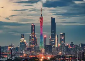
Canton Tower
8.6
4.5/533682 Reviews
From US$20.76
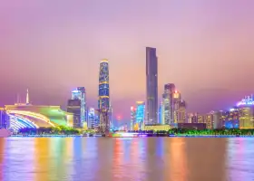
Pearl River Night Cruise
7.9
4.5/57600 Reviews
Save US$4.15
From US$13.57

Chimelong Bird Park
7.2
4.7/53220 Reviews
From US$10.94
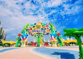
Sunac Land
6.3
4.8/57284 Reviews
Free
Nearby Attractions
Chimelong Safari Park | Guangzhou Chimelong Tourist Resort | Canton Tower | Chimelong International Circus | Chimelong Paradise | Pearl River Night Cruise | Shamian Island | Guangdong Science Center | Chimelong Water Park | Chimelong Bird Park | Chen Clan Ancestral Hall | Guangzhou Zoo | Baiyun Mountain | Grandview Mall | Grandview Aquarium | Guangdong Provincial Museum | Guangzhou Tower Ferris Wheel | NANYUE KING MUSEUM | Sun Yat-Sen Memorial | Shangxiajiu Pedestrian Street | Guangzhou Big Buddha Temple | Pearl River Night Cruise Tianzi Wharf | Sacred Heart Cathedral | Shawan Town | South China Botanical,Chinese Academy of Sciences | Yuexiu Park | Beijing Road Pedestrian Street | Yongqing Lane | Lychee Bay Scenic Area | Lingnan Impression Park
Popular Types of Attractions in Guangzhou
Parks | City Parks | Children's Play Areas | Water Parks | Architecture & Landmarks | Squares | Featured Neighborhoods | Historical Architectures | Lifestyle | Libraries | Campgrounds | Resorts | Religious Sites | Memorial Temples | Churches and Cathedrals | Temples | Exhibition Centers | Fine Art Galleries | Museums | Memorial Halls | Nature | Mountains | Beaches | Forests | Fitness | Badminton Courts | Stadiums | Basketball Courts | Historic Sites | Historical Sites
Popular Restaurants in Guangzhou
Caffe Mondo | Yue Chinese Restaurant (Sheraton Guangzhou Hotel) | Yue Jing Xuan | Jiang by Chef Fei | Lingnan House | Panda All Day Dining | ZI ZHOU LOU | Howard’s Gourmet Guangzhou | BingSheng Private Kitchen (Tianhe East Road) | Zhongbo Art hotel·Dian Dou De (Ju Fu Lou) | Penhouse | BingSheng Mansion | Suyab Courtyard・Pickmoon Gourmet | Li Yuan Restaurant (YiAn Plaza) | Lai Heen | Yue Creative Cantonese Cuisine | white tiger | Li Chateau | Lai Wan | THE GOVERNOR | CHAO YUE | Rêver | 陈添记(十五甫三巷店) | Ebony | Char Bar & Grill | Le Grill @ Sofitel Guangzhou Sunrich | Tian bar | Atrium | Skov River Resort · All-day restaurant | Nanxin Milk Dessert
Popular Destinations
Nice Travel | Cambodia Travel | Kathmandu Travel | Ningbo Travel | Vittoria Travel | Ulaanbaatar Travel | Anji Travel | Manchester Travel | Edinburgh Travel | Palma de Mallorca Travel | Bangkok Travel | Lucban Travel | Osaka Travel | Don Mueang Travel | Basking Ridge Travel | Shillong Travel | Haizhu District Travel | Shaanxi Travel | Dexing Travel | Shtakulskaya Travel | Grant Travel | Old Bhampur Travel | Burgpreppach Travel | Vivsya Travel | Champagne Travel | Champeguano Travel | Adams Travel | Mangli Travel | Guamacho Travel
Recommended Attractions at Popular Destinations
Bangkok attraction near me | Tokyo attraction near me | Manila attraction near me | Hong Kong attraction near me | Seoul attraction near me | Taipei attraction near me | Los Angeles attraction near me | New York attraction near me | Shanghai attraction near me | Kuala Lumpur attraction near me | Shenzhen attraction near me | Osaka attraction near me | London attraction near me | Singapore attraction near me | Guangzhou attraction near me | San Francisco attraction near me | Beijing attraction near me | Macau attraction near me | Bali attraction near me | Paris attraction near me | Orlando attraction near me | Ho Chi Minh City attraction near me | Jakarta attraction near me | Chicago attraction near me | Phuket attraction near me | Toronto attraction near me | Dallas attraction near me | Cebu attraction near me | Istanbul attraction near me | Seattle attraction near me
Trending Travelogues
2024 Guangzhou Travel Guide: Plan Your Travel To Guangzhou | Chimelong Safari Park Guide: Facts and Useful Information | A Guide to the World's Top-10 Zoos | Hot Spring is the Perfect Match of Autumn, Let's Take a Hot Spring in Guangzhou | We Also Recommended You Try The Charming Guangzhou Snack Bar | 8 Must-See Genuine Cantonese-Style Breakfast Teashop of Guangzhou | 10 Traditional Establishments for Classic Cantonese Foods | With Tens of Thousands of Visitors, Just Why is this Internet Celebrity Street So Popular? | 10 Best Attractions in Guangzhou | Top 20 Cantonese Cuisine in Guangzhou | What You Must Know before Visiting Chimelong Paradise Guangzhou | Ultimate Practical Tips for Canton Tower
Popular Trip Moments
Guangzhou | "Jeju Island" | The most comfortable walking route I've ever taken in Guangzhou! Enchanted Forest | Looking for a place to take your kids on a rainy day in Guangzhou? Check out the first JD Mall | What could best describe you, the Guangzhou State to Luxury Xianglan Guanzhou Hotel | The ultimate kid-friendly destination! Nairebao! Bring your kids for endless fun! | This is not a Suzhou garden, but the Lanpu Garden in Guangzhou | Guangzhou!! Affordable Hotel!! Don't want to check out, will come again next time! | If you've never taken your child to a place where you can only visit once, I advise you to go | Enjoy slow living at the Garden Hot Spring Resort Hotel | Lying in the hotel and looking at the ancient architecture of Yongqing Fang, it's stunning | Have you not visited Nansha Puzhou Garden yet? | Luhu Park~Azaleas | The air is fresh, and the streams are clear! | Discover a Treasure Homestay in Guangzhou | Yuewanwan | The Legend Hotel in Guangzhou! You really have to stay there once, the experience is amazing | Zengcheng Square - All comfortable needs | Just got back from Chimelong Water Park, feel free to ask | Grandview Mall, a new paradise for kids' outings | Weekend Destination/Guangzhou Bangkok Garden | My Labor Day Holiday | Let's start camping mode together~ | Don't crowd Yongqingfang anymore, it's also nice to visit this free small town to avoid the crowds | Grandview Mall is not just a shopping center, it is also a national 4A-level tourist attraction | A Guide to Hiking in Baishuizhai, Zengcheng, Guangzhou | Live streaming is the best way to experience an aquarium | A perfect spring outing spot for the whole family: Huadu Baosang Garden | Hai Xin Sha East, enjoy the fashionable vacation in the city! Unique location! | Vacation Recommendation | Escape the hustle and bustle, Dongfang Village·Senye Resort awaits your exploration | A literary mind blossoms at the Wanbo CBD Guangzhou Book Center | Guangzhou Edition·The Life We Long For: Secluded Living in the Forest | The Yuntai Garden, full of Chinese roses, is truly beautiful, worthy of being called Guangzhou's Monet garden
Popular Travel Types
More Things To Do in Guangzhou
China eSIM Day Pass/data Package days selected without cards QR code | Mainland China esim|High-speed unlimited Traffic, daily 500MB/1GB/2GB/3GB, total 3GB/5GB/10GB/20GB/30GB/50GB | Guangdong Gulong Gorge + Gulong Gorge Rafting + Gulong Gorge Yuntian Glass Bridge + Gulong Gorge Waterfall Group + Gulong Gorge Waterfall Glass Bridge One-Day Tour [Guangzhou Shenzhen Dongguan Qingyuan Zhuhai Zhongshan Foshan] | China&Hong Kong&Macau&Taiwan eSIM Day Pass/data Package (QR code) | China + Hong Kong + Macau esim|High speed daily 500MB/1GB/2GB/3GB, total capacity 3GB/5GB/10GB/20GB/50GB | eSim China 1/3/5/7/15 Days with Global Access | Hong Kong Victoria Peak + Wong Tai Sin Temple + Repulse Bay + Hong Kong Convention and Exhibition Centre + Victoria Harbour Day Tour [China Travel Brand + 20-person Small Group/Michelin Food and Beverages Meal/Pure Play] | Asia eSIM Day Pass/Data Package (QR Code) | eSender - Mainland China eSIM daily package/traffic package, days optional. No need to get the card QR code | Off-road vehicle driving experience at Shandianshui Off-Road Club, Baiyun District, Guangzhou, Guangdong [Professional coach leading the team + team building and expansion selection] | 【Hong Kong-Guangdong Express】Cross-border direct Bus from Hong Kong to Guangzhou (Guangzhou City/Panyu Chimelong/Huadu Sunac) | dtac GO INTER eSIM|Asia, Australia, USA 10Days 6GB Unlimited Data | Guangzhou Standard Price Shanshui Tent Camping· Camping (stay overnight) [Zhenyi Tent Chalet | Includes Breakfast for Two people + tickets for 2 large and 2 small swimming pools + free amusement coupons] | Guangdong Huizhou Xunliao Bay + Shuangyue Bay + Shili Silver Beach + Lover's Beach One-Day Tour [Quality Pure Play, Free Car Return to Guangzhou the Next Day | "Heaven-Given Platinum Dike, China's Maldives"] | Guangdong Yangjiang Hailing Island + Zhapo + Shili Silver Beach + Dajiao Bay Water Activities One-Day Tour [Quality Pure Play, Free Car Return to Guangzhou the Next Day | "China's Pattaya, Oriental Hawaii"] | From Guangzhou! To the stage of the movie “Avatar”! [World Heritage] 3-day trip to Zhangjiajie including Wulingyuan Tianzi Mountain, Yuanjiajie, Huangshizhai, and Tianmen Mountain, lunch included <Hotel pick-up/Japanese guide/1 person departure> | China Visa application Travel Visa L Visa Tourist Visa from HongKong | Pearl River Estuary Opium War Naval Ancient Fort Private Tour | Private Guangzhou Lay Over Tour with 9 Options | Guangzhou Chimelong Safari Park Private Guided Tour | Private Baiyun Airport Arrival Transfer to Guangzhou City Area | 1 Day Guangzhou City Highlight Layover Tour from Airport | Visa to China Application Service from Singapore - (M) Business Visa | Private Guangzhou Business Tour to Visit Factory and Local Market | Guangzhou Canton Fair Chinese-English Translation (Business Translation | General Translation on Foot, Chinese-English, On-site Translation, Accompanying Translation) Ly | One-day tour of Canton Tower + Guangdong Provincial Museum + Whampoa Military Academy Site Memorial Hall [Business and leisure, private car transfer, free and flexible, itinerary is adjustable] | The Best of Guangzhou-Foshan Walking Tour | Guangzhou Day Tour- Cantonese Culture and Life Experience | Kaiping Diaolou Day Tour to Zili, Li yuan, Chikan Village from Guangzhou | Cantonese Dim Sum Dinner with Pearl River Night Cruise in Guangzhou
Payment Methods
Our Partners
Copyright © 2024 Trip.com Travel Singapore Pte. Ltd. All rights reserved
Site Operator: Trip.com Travel Singapore Pte. Ltd.
Site Operator: Trip.com Travel Singapore Pte. Ltd.
Usually drive often, through the Niubishan tunnel, in fact, here is the Niubishan here, the Niubi's Niubi nose is the tunnel, and then walking on it, you can see some green scenery here, there is a section similar to the Great Wall and the like, In fact, it is above the tunnel, it is quite interesting, a place is next to the highway.
Niutou Mountain, Tianlu Lake in the northeast of Guangzhou City, the mountain is not high, it is a leisure park in the city, the week is not coming, relax, Fang Song mood, breathe fresh air, and have fun with relatives and friends.
The mountains in the big city, the scenery is good, the air is good.
Niutou Mountain is located in Lianhe Township, the northeast suburb of Guangzhou City, the main peak sea is 362 meters, belonging to the after-mai of Jiulian Mountain. This mountain and Maofeng Mountain, Yau Ma Mountain, Phoenix Mountain, Taihe Mountain are connected to a number of peaks more than 350 meters, climbing high and looking far, the layers are stacked and reckless, and the scenery is spectacular! Niumu Line is the favorite line for junior hiking pot friends to walk, from Niutou Mountain, to Muqiang Reservoir, climbing to the valley, the valley through stone forest, and then through the deep bamboo forest, there is a feeling of you experiencing the movie. The original scenery is rich and varied, and you can see the four seasons. Those who have never seen forests and deep valleys in the city can walk up to the United Terminal (Supply Point) - Niutou Mountain (362 meters) - Valley Jiaolin - Stream - Nobu Point - Stonehenge - Bage Village (Jute Village) (Supply Point) - Yangchang Highway - Natural Gas Pipeline - Expressway Handong - Reservoir Zhulin - Muqiang Reservoir Outside The line is just after crossing the highway culvert, turn left around the Muqiang Reservoir, more than half a circle of books.
⽜⽊ Line Hiking: ⽜⽊ Line, that is, the hiking route between ⼴ City ⽜ Head ⼭ to ⽊ Strong ⽔ Library, is the hiking route at ⼴ State Outdoor ⼊ Gate-level. The whole journey is ⼭ ground, there are ⼀ chaos ⽯ slopes. ⼀ like the whole journey is about 16KM, suitable for outdoor ⼈ groups with ⼀ Dingnan ⼒. It is expected that around 17:00 pm, ⾛ to ⽊ strong ⽔ library will end. Routine profile: ⼭ wild hiking, the whole process ⼤ is 16KM, suitable for ⼈ groups with ⼀ fixed hiking experience and ⼒ resistance. Underage ⼈ must be accompanied by guardian ⼈.